|
|
| Temp (Air): | 80.4°F |
| Dew Point: | 74.3°F |
| Winds: | 16 knots E (90 deg true) |
| Gusts: | 17 knots |
| Pressure: | 30.05 in (--0.01 in) |
|
|
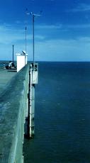
| Owned and maintained by: | National Data Buoy Center |
| Station Lat, Lon: | 29.86N, 81.26W |
| Buoy type: | C-MAN Station |
| Station elevation: | 0 m above mean sea level |
| Air temp height: | 7.6 m above site elevation |
| Anemometer height: | 16.5 m above site elevation |
| Barometer elevation: | 8.8 m above mean sea level |
|
 |
| A marine forecast is not available for this station. |
10/05/2025
5:00pm | 80.4° | - | 74.3° | 16 kts E (90°)
Gusts: 17 | 30.05 | - | - | - | - | 10/05/2025
4:00pm | 76.6° | - | 74.8° | 12 kts E (100°)
Gusts: 13 | 30.05 | - | - | - | - | 10/05/2025
3:00pm | 77.2° | - | 73.6° | 20 kts E (80°)
Gusts: 24 | 30.05 | - | - | - | - | 10/05/2025
2:00pm | 80.1° | - | 73.2° | 20 kts E (100°)
Gusts: 22 | 30.06 | - | - | - | - | 10/05/2025
1:00pm | 79.9° | - | 73.6° | 18 kts E (100°)
Gusts: 21 | 30.06 | - | - | - | - | 10/05/2025
12:00pm | 80.6° | - | 73.2° | 19 kts E (100°)
Gusts: 21 | 30.06 | - | - | - | - | 10/05/2025
11:00am | 80.6° | - | 73.6° | 20 kts E (100°)
Gusts: 22 | 30.09 | - | - | - | - | 10/05/2025
10:00am | 80.4° | - | 73.8° | 19 kts E (100°)
Gusts: 22 | 30.09 | - | - | - | - | 10/05/2025
9:00am | 80.4° | - | 73.8° | 20 kts E (100°)
Gusts: 21 | 30.09 | - | - | - | - | 10/05/2025
8:00am | 80.4° | - | 75.4° | 20 kts E (100°)
Gusts: 23 | 30.08 | - | - | - | - | 10/05/2025
7:00am | 77.5° | - | 73.8° | 20 kts E (100°)
Gusts: 22 | 30.07 | - | - | - | - | 10/05/2025
6:00am | 78.6° | - | 74.5° | 19 kts ESE (110°)
Gusts: 21 | 30.04 | - | - | - | - | 10/05/2025
5:00am | 77.2° | - | 74.5° | 9 kts E (80°)
Gusts: 10 | 30.02 | - | - | - | - | 10/05/2025
4:00am | 79.0° | - | 74.7° | 17 kts ESE (110°)
Gusts: 19 | 30.01 | - | - | - | - | 10/05/2025
3:00am | 79.7° | - | 74.5° | 14 kts ESE (110°)
Gusts: 15 | 29.99 | - | - | - | - | 10/05/2025
2:00am | 79.9° | - | 73.9° | 14 kts SE (120°)
Gusts: 16 | 30 | - | - | - | - | 10/05/2025
1:00am | 79.9° | - | 74.1° | 13 kts ESE (110°)
Gusts: 15 | 30.01 | - | - | - | - | 10/05/2025
12:00am | 80.1° | - | 73.9° | 14 kts E (100°)
Gusts: 16 | 30.01 | - | - | - | - | 10/04/2025
11:00pm | 80.1° | - | 73.0° | 14 kts ESE (110°)
Gusts: 15 | 30.02 | - | - | - | - | 10/04/2025
10:00pm | 79.5° | - | 73.8° | 13 kts E (80°)
Gusts: 15 | 30.03 | - | - | - | - | 10/04/2025
9:00pm | 79.3° | - | 73.8° | 15 kts ENE (70°)
Gusts: 18 | 30.04 | - | - | - | - | 10/04/2025
8:00pm | 79.7° | - | 72.7° | 16 kts ENE (70°)
Gusts: 17 | 30.04 | - | - | - | - | 10/04/2025
7:00pm | 79.9° | - | 71.4° | 16 kts ENE (70°)
Gusts: 18 | 30.02 | - | - | - | - | 10/04/2025
6:00pm | 79.9° | - | 71.6° | 16 kts ENE (70°)
Gusts: 18 | 30.01 | - | - | - | - | 10/04/2025
5:00pm | 79.9° | - | 71.1° | 17 kts E (80°)
Gusts: 18 | 30.02 | - | - | - | - |
| A detailed wave summary is not available for this station. |
| The latest Satellite Wind Map is unavailable for this location. |
| SAUF1 | 29.86N | 81.26W | St. Augustine, FL |
| GTQF1 | 29.67N | 81.26W | Pellicer Creek, Guan Tolomato Matanzas Reserve, FL |
| GTXF1 | 29.66N | 81.23W | Pellicer Creek, Guana Tolomato Matanzas Reserve, FL |
| 41117 | 30.00N | 81.08W | St. Augustine, FL (194) |
| RCYF1 | 29.80N | 81.55W | 8720625 - Racy Point, St. Johns River, FL |
| GCVF1 | 29.98N | 81.63W | 8720503 - Red Bay Point, St. Johns River, FL |
| BKBF1 | 30.19N | 81.69W | 8720357 - I-295 Buckman Bridge, St Johns River, FL |
| LTJF1 | 30.38N | 81.45W | 8720228 - Little Jetties, St. Johns River, FL |
| SJLF1 | 30.40N | 81.40W | St. John's Light |
| MYPF1 | 30.40N | 81.43W | 8720218 - Mayport (Bar Pilots Dock), FL |
| BLIF1 | 30.39N | 81.52W | 8720233 - Blount Island Command, St Johns River, FL |
| JXUF1 | 30.35N | 81.61W | 8720245 - Jacksonville University, FL |
| DMSF1 | 30.39N | 81.56W | 8720219 - Dames Point, FL |
| NFDF1 | 30.40N | 81.63W | 8720215 - Navy Fuel Depot, St Johns River, FL |
| 41012 | 30.04N | 80.53W | St. Augustine, FL 40NM ENE of St Augustine, FL |
Data provided by National Data Buoy Center
|

|